CDW CHATTANOOGA DRONE WORKS

Chattanooga-based commercial drone services

Commercial Drone Services for Aerial Data, Mapping & Site Documentation

Construction documentation, orthomosaic mapping, inspections, land visualization, 360° site tours, commercial media, and custom project portals across Tennessee, North Georgia, and Northern Alabama.

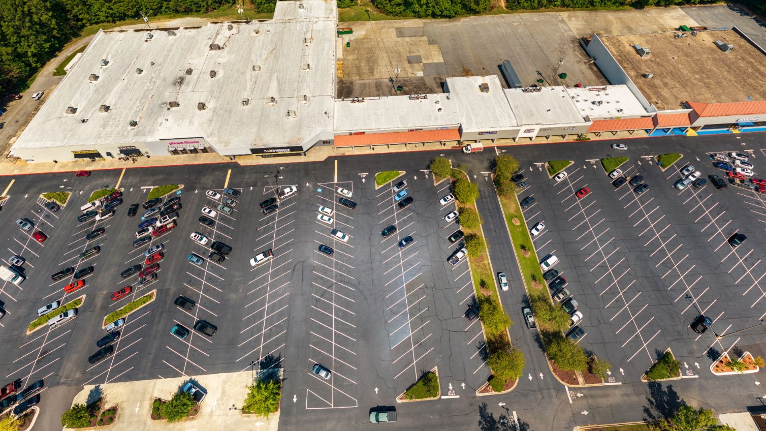
Aerial construction site documentation example
Field capture to usable deliverables Photos, maps, overlays, portals, timelines, and reporting-ready files.

Core commercial services

Drone deliverables built around the project, not just the flight

Each service can stand alone or combine into a custom portal for owners, contractors, brokers, property teams, and remote stakeholders.

Construction

Construction Documentation

Recurring aerial, ground, map, and progress documentation for active sites.

Typical deliverables

  • Progress photos and video
  • Orthomosaics and plan overlays
  • Online project pages clients can open and share in a browser

Why it matters

  • Keeps owners and project teams current without another site visit
  • Creates a consistent visual record as work changes
  • Makes progress easier to share in updates and meetings
  • Combines photos, maps, and portals around the project
View service
Mapping

Orthomosaic & RTK Mapping

High-resolution map outputs for site context, planning support, and visual reporting.

Typical deliverables

  • Orthomosaic and GeoTIFF outputs
  • Interactive online maps clients can open and share in a browser
  • RTK-supported capture when appropriate

Why it matters

  • Shows the full site in a way standard photos cannot
  • Gives teams a clear visual reference for planning and reporting
  • Makes progress and site changes easier to compare over time
  • Turns aerial capture into map-level project context
View service
Interactive

360° Site Tours

Aerial and ground panoramas that let stakeholders inspect a site remotely.

Typical deliverables

  • Linked panoramic viewpoints
  • Hotspots and navigation
  • A shareable online tour clients can open in a browser

Why it matters

  • Lets remote stakeholders explore a site on their own time
  • Shows context and location more clearly than isolated photos
  • Reduces the need to explain the same site conditions repeatedly
  • Creates a shareable point of reference for project updates
View service
Inspections

Telecom Tower Inspections

High-resolution visual documentation for towers and vertical assets.

Typical deliverables

  • Detailed visual asset documentation
  • Organized image delivery
  • Annotated review visuals

Why it matters

  • Documents hard-to-reach assets without relying on memory alone
  • Gives teams detailed visuals before deciding what needs attention
  • Creates an organized record for maintenance planning
  • Helps share conditions with people who are not on site
View service
Land

Land & Parcel Visualization

Aerial context that helps buyers and stakeholders understand access, shape, terrain, and surroundings.

Typical deliverables

  • Parcel-style aerial visuals
  • Access-route graphics
  • Property-context imagery

Why it matters

  • Helps buyers understand shape, access, terrain, and surroundings quickly
  • Makes larger parcels easier to explain than ground-level photos alone
  • Gives brokers and owners stronger visual context for discussions
  • Presents a property from the perspective buyers actually need
View service
Commercial

Commercial Property Media

Drone media and site visuals for commercial property, development, leasing, and marketing.

Typical deliverables

  • Aerial photo and video
  • Roof and site overview
  • Broker-ready media

Why it matters

  • Shows a property’s setting, access, scale, and surrounding activity
  • Gives leasing and sales material more useful site context
  • Helps decision-makers see the property before they visit
  • Creates visual assets that work across listings and presentations
View service
Real Estate

Real Estate Media

Listing media, acreage visuals, premium property pages, and broker-ready assets.

Typical deliverables

  • Listing photo sets
  • Property video
  • Acreage and location visuals

Why it matters

  • Helps a listing stand out with a clearer sense of the property
  • Shows acreage, location, and setting in one visual story
  • Gives prospective buyers useful context before scheduling a visit
  • Provides polished media brokers can use right away
View service

Why CDW

Direct operator access with custom deliverables

Work directly with the person planning, flying, processing, and delivering the project, with outputs shaped around the actual site and client need.

No required enterprise subscriptionDeliverables can be packaged into client-friendly portals and file links.
Built around the sitePhotos, plans, maps, 360 views, timelines, and annotations can be combined.
Regional and responsiveChattanooga-based coverage for TN, North Georgia, Northern Alabama, and regional travel.

Flagship service

Construction Progress Documentation From the Air, Ground, and Map

Recurring construction documentation gives owners, developers, and project teams a better visual record than basic drone photography.

Capture options

One-time baseline, milestone-based, monthly, twice-monthly, weekly, and completion packages.

Documentation outputs

Aerial photos, progress video, orthomosaics, 360 panoramas, plan overlays, comparisons, and portals.

Delivery workflow

Scope, plan, capture, process, deliver, and maintain an organized project record.

Trust and field readiness

Professional capture, practical safety, and grounded claims

FAA Part 107 Insured OSHA 10 Navy Veteran Owned RTK-Capable Equipment Site-Specific Planning

Before hiring a drone documentation provider, ask:

  1. Is the pilot FAA-certified and insured?
  2. How will coverage, image quality, and deliverables be checked?
  3. Does the capture method match the job?
  4. Can the provider repeat views over time?
  5. Will you receive usable outputs, not just raw images?
  6. Can the deliverables fit your reporting workflow?
  7. Are claims limited to real capabilities?

Project intake

Need aerial documentation, mapping, or inspection media for a project?

Share the project type, location, timing, and deliverables you need. Submit the secure project form below. Your request is saved directly and reviewed by Chattanooga Drone Works.

Call or text 423-250-3443