Owners & Developers
Track visible progress, document milestones, and share clearer updates with investors, partners, or internal teams.
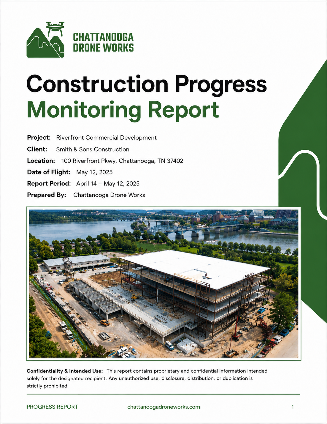
Construction documentation
Recurring aerial photos, progress video, orthomosaic mapping, 360° site tours, overlays, and custom portals for owners, developers, contractors, and project teams that need a clearer visual record.
Who it helps
Construction documentation is useful when progress needs to be reviewed, shared, compared, archived, or explained to people who are not on site every day.
Track visible progress, document milestones, and share clearer updates with investors, partners, or internal teams.
Create consistent visual records that help explain site status, access, staging, work areas, and change over time.
Use repeatable imagery, maps, and portals to keep remote stakeholders aligned without digging through scattered photos.
Problems solved
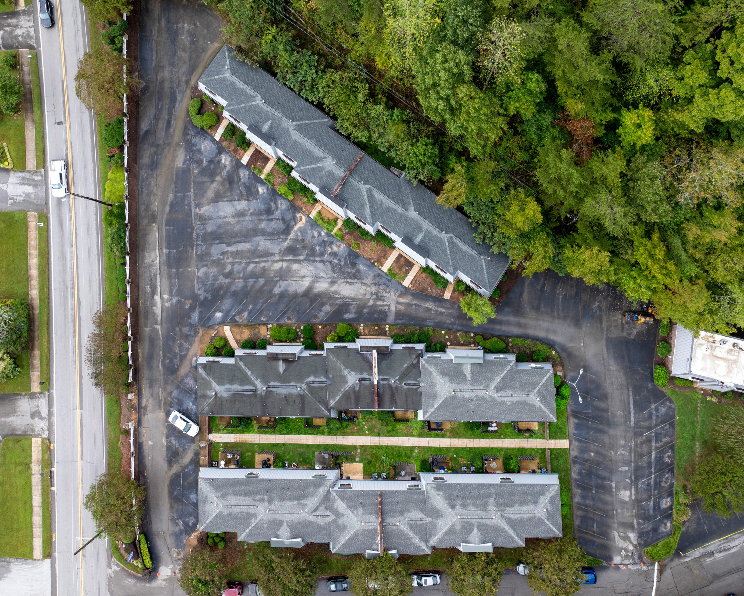
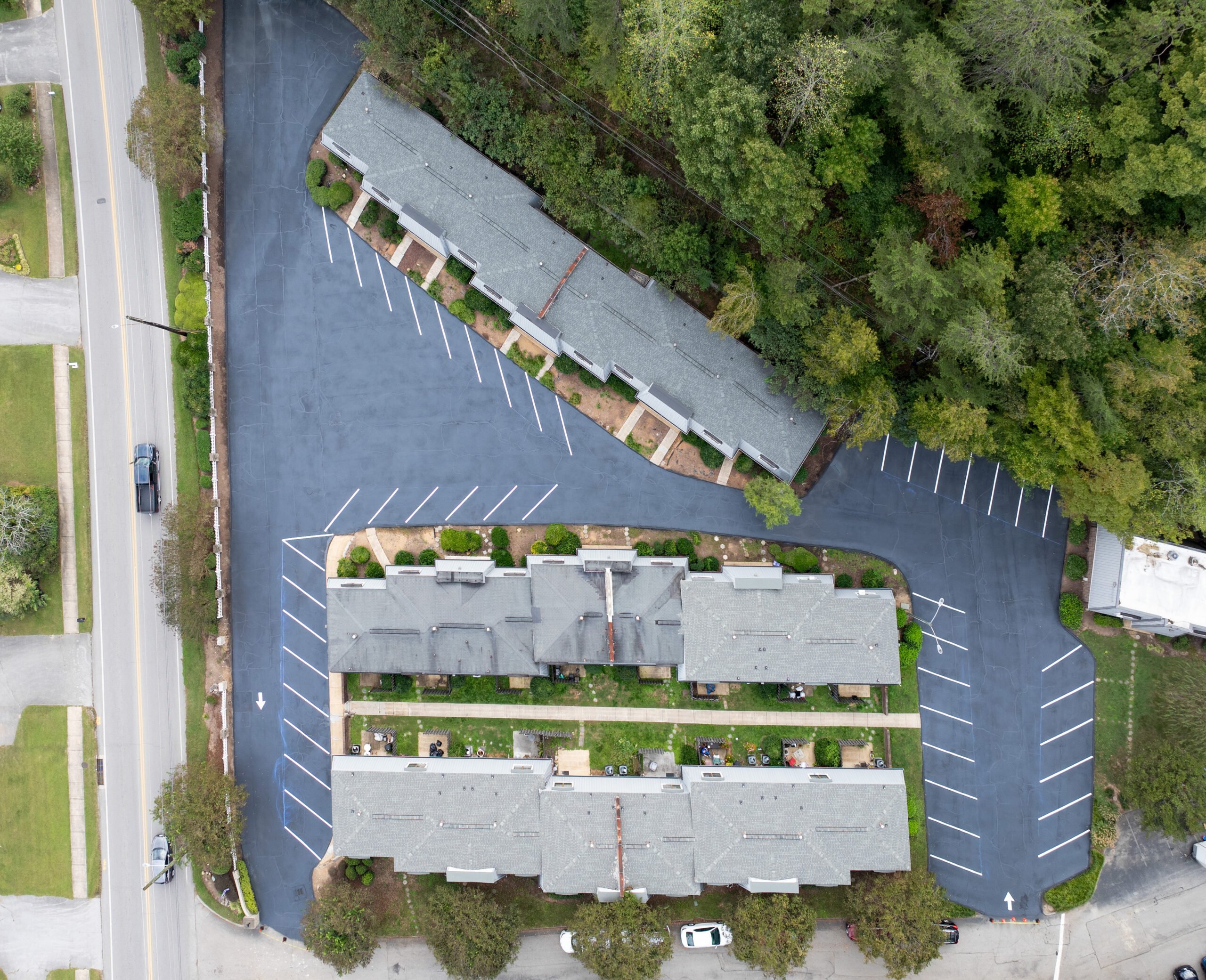
Repeatable aerial and ground views make it easier to compare changes across visits.
Owners, investors, and managers can review project context without being physically present.
Orthomosaics, overlays, 360 views, and before/after comparisons can make progress easier to understand.
Capture options
Pricing stays quoted by scope. Site size, travel, access, deliverables, processing, and schedule all affect the final quote.
Initial site documentation before work begins, before a milestone, or before a major change.
Capture around clearing, grading, vertical construction, paving, completion, or other key stages.
Recurring visibility for general progress records and owner updates.
More frequent documentation for active sites with visible changes every few weeks.
High-frequency documentation for fast-moving projects or regular stakeholder reporting.
Final imagery, video, map, and portfolio-ready media after a project or phase is complete.
Deliverables
Aerial progress photos, edited progress video, repeatable camera angles, before/after comparisons, and completion media.
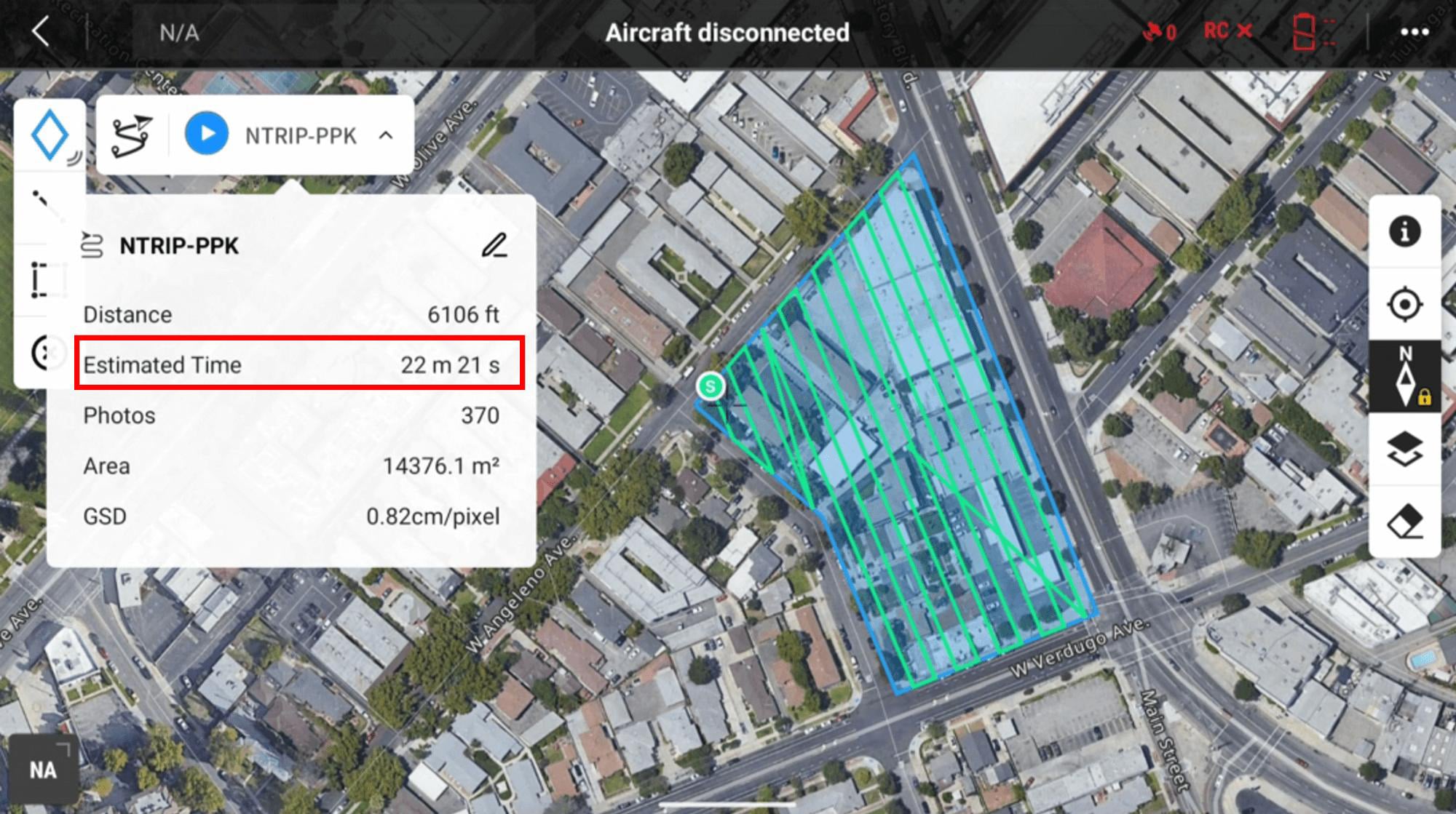
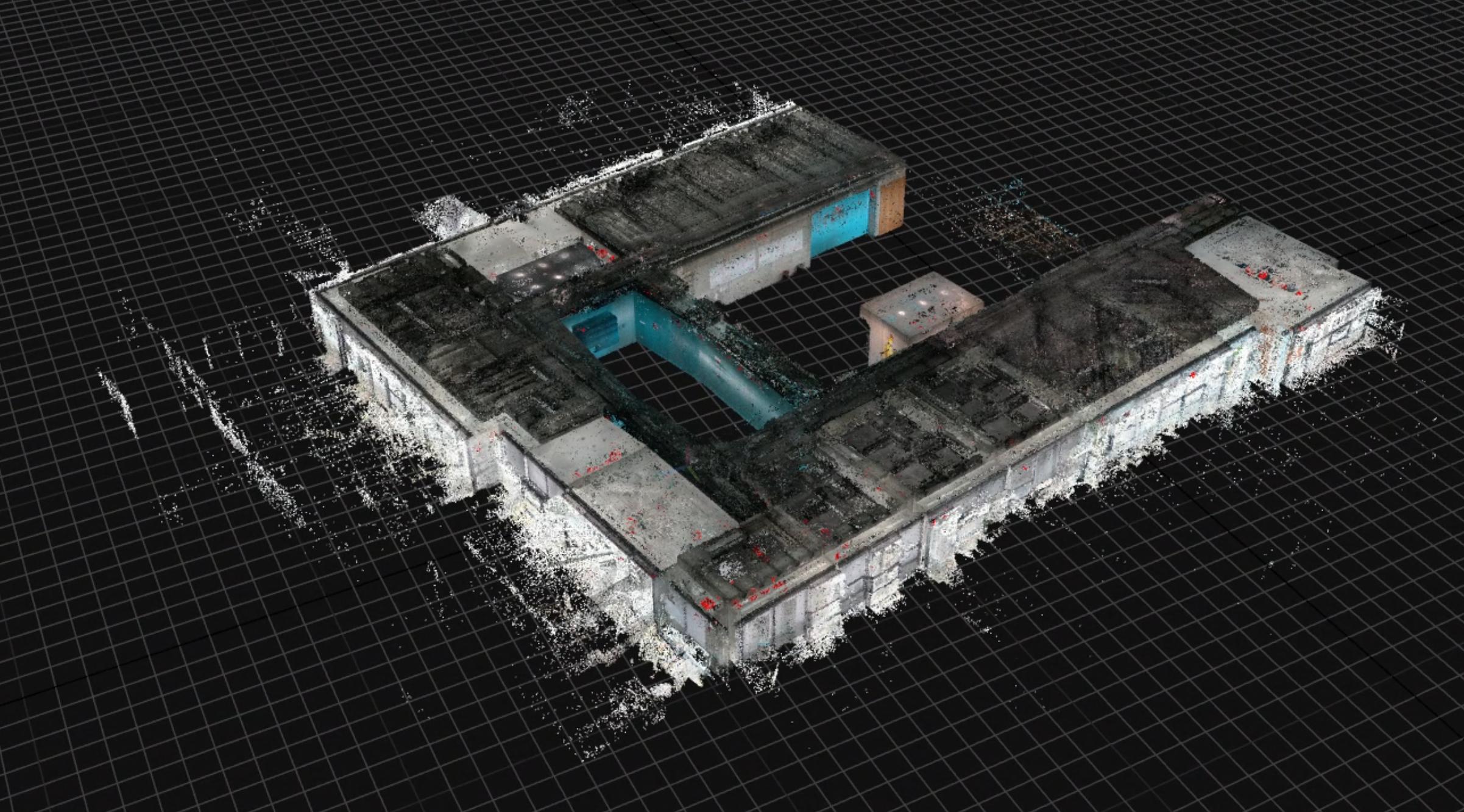
Orthomosaic maps, RTK-supported capture when appropriate, site-plan overlays, annotations, and map-style exports.
360 aerial or ground panoramas, interactive portals, organized cloud delivery, internal archives, and public-facing project pages when needed.
Sample work
Compare resurfacing progress and explore an interactive site example using the controls below.
Workflow
Scope the site, deliverables, schedule, access, airspace, weather, and site rules.

Collect repeatable aerial, ground, map, or panorama data based on the project need.
Prepare imagery, maps, overlays, comparisons, reports, and portal assets.
Provide organized files, links, reports, portals, and an archive that can be updated over time.
Safety and site procedure
Flights are planned around FAA requirements, airspace, weather, site access, people, equipment, PPE/site rules when applicable, and project-specific risks.
FAQ
No. Mapping and boundary-style visuals are for documentation, planning support, and visualization unless a licensed surveyor is involved.
Monthly works for general progress. Twice-monthly or weekly is better for active sites with fast changes or regular reporting needs.
Yes. Repeatable viewpoints and consistent capture planning can make comparisons easier across visits.
Yes. Orthomosaic outputs can be included when the project needs map-style site visibility.
Yes, when suitable plan files or reference data are available.
Yes. Deliverables can be prepared for internal review, public-facing updates, or both.
Project intake
Start with the location, site size, schedule, capture frequency, and deliverables you need. Plans, KML/KMZ files, or reference images can help scope the work.
Or call 423-250-3443